Official season
June 1 to Nov 30
The Atlantic basin calendar
Loading page content.
Loading Planning Guides
Preparing itineraries, logistics, and practical travel tools.
Compiling planning guides and trip resources tailored for Belize.
Stay in the know
Belize
before
everyone else.
Events, hidden gems, seasonal highlights, and local stories, delivered straight to your inbox before they go viral.
Loading page content.
Loading Travel Tips
Compiling essential tips and advice for visiting Belize.
Preparing destination details and local recommendations.
Keep Planning
Belize health & safety, the practical side: tap water, mosquitoes and Zika, vaccines, marine and dive hazards, clinics, and travel insurance for 2026.
How much Belize costs by travel style, with sample budgets for San Ignacio, Caye Caulker, Placencia, San Pedro, transfers, tours, food, and cash planning.
Getting around Belize made simple: water taxi schedules to the cayes, Tropic Air domestic flights, NBC bus timetables, BZE airport transfers, shuttles, and rental cars.
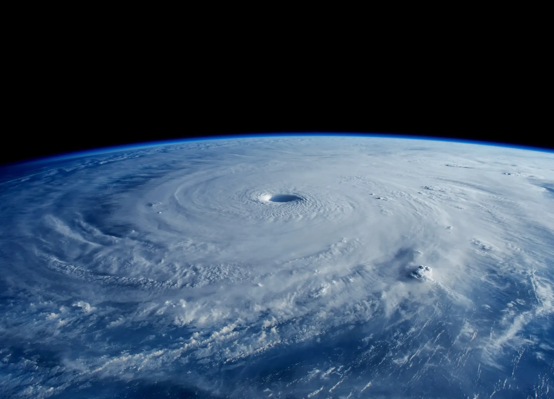
The dates, the months that matter, the 2026 NOAA outlook, and a live National Hurricane Center status check
Belize follows the Atlantic hurricane season, June 1 to November 30. Atlantic activity is historically concentrated from mid-August to mid-October, but storms can occur outside the official season. A seasonal outlook does not tell you whether Belize will be hit: use current official advisories for an approaching system.
Official season
June 1 to Nov 30
The Atlantic basin calendar
Belize focus
Aug to early Nov
October has the most landfalls on record
Local storm threat
Check advisories
Season totals do not predict landfall
2026 outlook
Below normal favored
Lower odds do not mean zero risk
By Rowan
Last reviewed August 15, 2026
Live Atlantic check
The status uses NOAA's National Hurricane Center feed, refreshed continuously at the source and checked when this page loads.
NOAA's National Hurricane Center publishes this 7-day graphical outlook for the whole Atlantic basin and refreshes it several times a day. Belize sits on the far western edge of the map, so anything shaded near the western Caribbean deserves a closer look.
Source: NOAA National Hurricane Center, refreshed several times daily.
Open the full NHC Atlantic outlookFor a deeper dive, Google DeepMind's experimental Weather Lab shows AI cyclone predictions, with formation, track, and intensity scenarios up to 15 days out, and is used to support National Hurricane Center forecasters. Explore DeepMind Weather Lab
NOAA 2026 outlook
NOAA’s August 6, 2026 Atlantic outlook assigns 75% probability to below-normal activity, 20% to near-normal and 5% to above-normal. Its ranges are 7 to 13 named storms, 2 to 6 hurricanes and 0 to 2 major hurricanes. These describe basin-wide activity, not the chance of a Belize landfall.
Outlook checked September 4, 2026; the issue date remains August 6, 2026. NOAA gives each storm-count range a 70% probability. Local impacts require current forecasts and official Belize guidance, even in a quieter Atlantic season.
Read NOAA's August 6, 2026 outlook updateBelow normal
75%
Near normal
20%
Above normal
5%
Named storms
7 to 13
Hurricanes
2 to 6
Major hurricanes
0 to 2
Month by month
The Atlantic season is a fixed calendar, but Belize's practical storm window is shorter. The central coast averages around 1,800 mm of rain a year, with a wetter far south and drier north. Coastal highs stay around 28 to 31°C and lows around 21 to 24°C. The table uses long-term Belize City area anchors, not a forecast for a specific trip.
| Months | Rain pattern | Storm risk | Trip read |
|---|---|---|---|
| Dec to Feb | Outside the June to November wet season; the rough dry-season window begins in late February. | None | No Atlantic hurricane-season monitoring is needed. |
| Mar to Apr | Dry season. April is the driest month, at roughly 45 to 50 mm around Belize City. | None | Storm risk is outside the Atlantic season. |
| May | The rough late-February to May dry-season window reaches its end. | None | The Atlantic season does not open until June 1. |
| Jun | Wet season begins. June is very wet, at roughly 250 mm around Belize City. | Season open, low | Start checking the Atlantic, though Belize's main risk window comes later. |
| Jul | Wet-season conditions continue across Belize. | Season open, low | Keep plans flexible and check the NHC feed before transfer days. |
| Aug | Wet season, often with the drier break locals call the little dry. | Elevated | Belize's practical hurricane window is now underway. |
| Sep | Wet-season conditions continue. | Peak | Use flexible bookings, weather cover, and regular official checks. |
| Oct | Wettest month around Belize City, at roughly 270 mm. | Peak | October has seen the most Belize landfalls on record. |
| Nov | The wet season continues through November. | Tapering | Belize-specific concern is highest early in the month; the Atlantic season ends November 30. |
Storm history
Belize's history shows why October gets the closest attention. These entries use the storm category at Belize impact and run from the most recent event backward.
November 17, 2024
Landfall near Dangriga with 40 mph winds and minimal damage.
November 2, 2022
Category 1 landfall about 18 km southwest of Belize City with 90 mph winds, about US$100M in losses, and no deaths.
September 2020
Category 1 landfall on the Stann Creek coast, with no deaths and about US$20M in damage.
August 2016
Category 1 landfall near Belize City.
October 2010
Hurricane landfall south of Belize City.
August 2007
Category 5 landfall just north of the border in Mexico, with serious damage in Corozal District.
October 2001
Compact Category 4 landfall at Monkey River Town near Placencia, with 24 deaths and about US$250M in damage.
October 2000
Category 4 storm that stalled just offshore over Ambergris Caye and Caye Caulker, with 19 deaths and about US$280M in damage.
October 31, 1961
Category 4 landfall just south of Belize City after peaking at Category 5 offshore. About 307 people died, and the destruction led Belize to move its capital inland to Belmopan.
September 10, 1931
Category 4 strike in the Belize City area with about 2,500 deaths, the deadliest disaster in the country's history.
No hurricane or tropical storm affected Belize in 2023 or 2025. The most recent event was Tropical Storm Sara near Dangriga on November 17, 2024.
From Bullet Tree Falls, Cayo
I live in Bullet Tree Falls, a village on the Mopan River a few miles from San Ignacio. Here, hurricane season is not really about the projected track on the map. It is about how fast the river comes up.
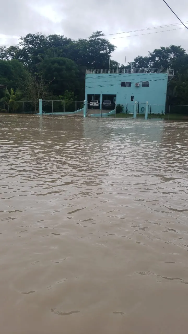
In October 2022 no hurricane made landfall in Belize. Hurricane Lisa was still three weeks away. What we got instead was days of rain, and that was enough. The Mopan rose into the lower parts of the village, streets disappeared, homes flooded, and the bridge toward Santa Familia went under. Once that happens, people on one side of the village are cut off from supplies and services on the other.
Around 104 people across the district left their homes for one of six shelters. My family was lucky, our house is on a hill and the water did not reach us the way it reached families closer to the river. I spent that week helping neighbours carry furniture and belongings up out of the low area, and people opened their own homes so others had somewhere dry to put what they had saved. We also went back for animals: chickens still in cages, dogs left tied while the water kept rising. In a flood everyone focuses on getting children and possessions out, and animals are easy to forget.
Two years earlier, Hurricane Eta did something similar from much further away. Eta made landfall in Nicaragua in November 2020, not Belize, and its outer rain bands still put Cayo under water. That is the pattern worth understanding. The storms that disrupted my village most were a storm that hit another country and a week of rain with no storm at all.
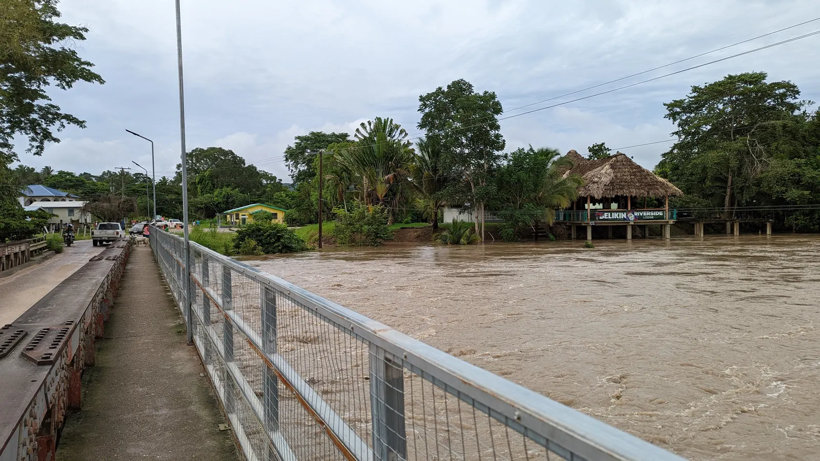
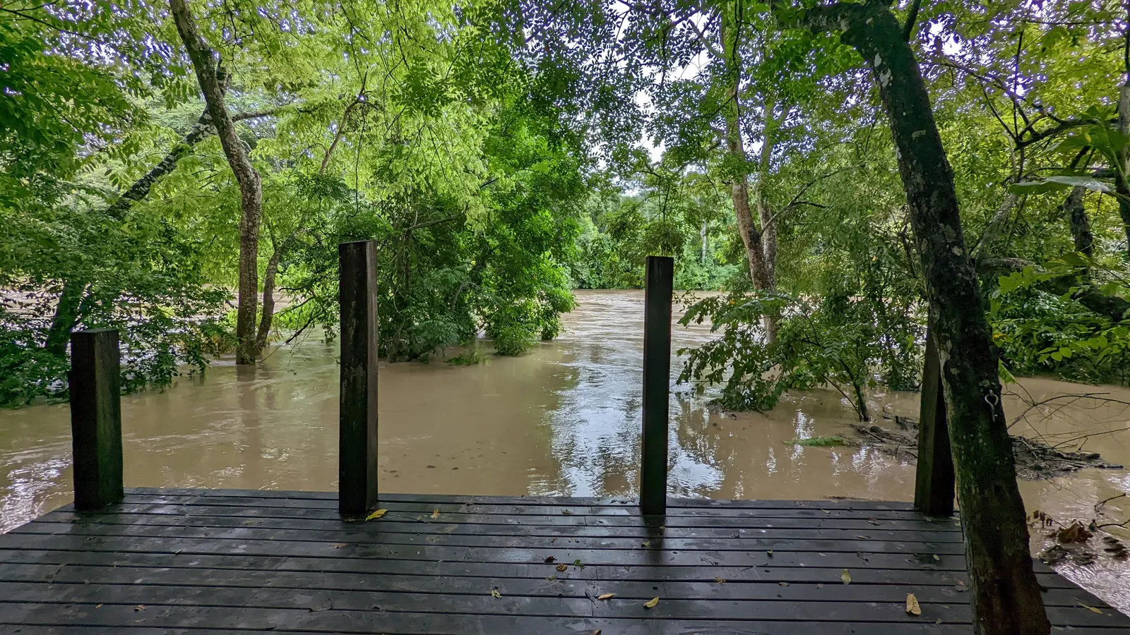
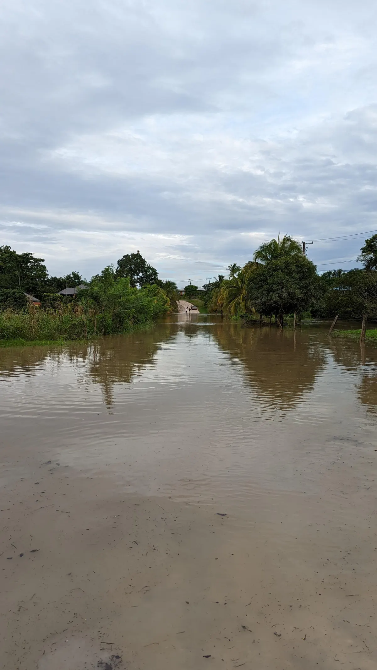
Travelers often judge storm safety by whether the hotel is concrete. Concrete handles wind. It does not give you electricity, running water, air conditioning, internet, or a working road.
During these events rising water can come close enough to transmission infrastructure that power is cut as a precaution, and outages have run along the San Ignacio to Belmopan corridor. On the cayes, water taxis and domestic flights stop before conditions get bad and do not resume the moment the rain stops. You can be perfectly safe in a solid building and still spend several days with no power and no way to leave.
Friends of mine on the islands leave early when a serious system looks likely. They take a water taxi or a flight to the mainland before transport gets crowded or suspended, and wait somewhere safe for the all clear. I understand that completely. Losing power and water on an island is a hard few days, and restocking the island takes time.
But moving to the mainland is not the same as moving somewhere safe. Cayo's hazard is not surge, it is the rivers. Bullet Tree Falls, Calla Creek and Santa Familia all flood. If you relocate off a caye, ask the property three things: is it on high ground, does the access road flood, and does it have backup power and water.
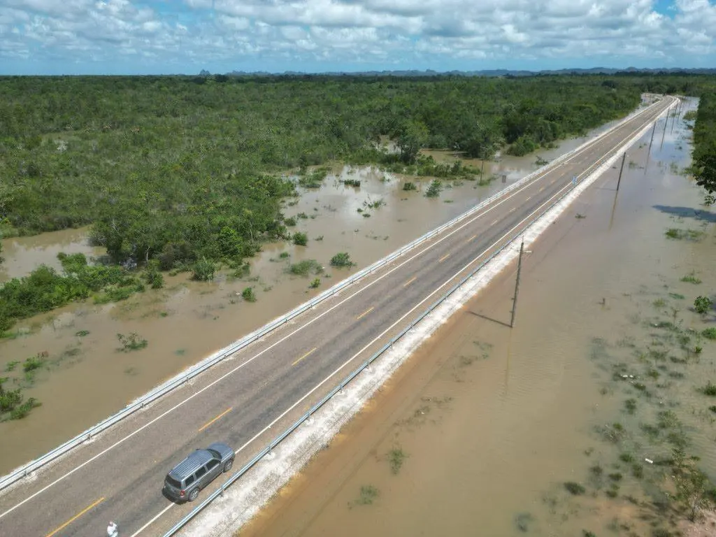
Roads are the part people underestimate. Your destination can be completely dry while a bridge or a low section between you and it is underwater. This is not only a hurricane problem. In June 2026, ordinary seasonal rain with no landfall closed part of the upgraded Coastal Plain Highway. If regular rain can overtop a new highway, a slow tropical system can shut a lot more.
A four-wheel drive helps on a muddy road that is officially open. It does nothing for a washed-out one. Never follow another driver into floodwater. You cannot see the current, the edge of the pavement, or what the water has taken out underneath. In parts of Bullet Tree Falls in 2022 the water was simply too deep to drive, and people moved by canoe instead.
I would not cancel a Belize trip because it falls between June and November. Most trips in those months pass without a storm touching them. I would build flexibility into the booking, and I would watch more than the projected track.
The safest mainland base is not the one furthest from the sea. It is the one on higher ground, away from a flooding river, reachable by an open road.
Hurricane Eta missed Belize. Its rain did not.
Reported coverage of the October 2022 Cayo floods
Region reality check
A Belize weather plan should follow geography. The cayes and coast prepare for wind and storm surge, while inland Cayo trades surge exposure for heavy rain and river flooding.
Wind and storm surge are the central concerns, so cayes are evacuated ahead of threatening storms. Keith sat over Ambergris Caye and Caye Caulker in 2000.
San Ignacio has no storm-surge exposure, but heavy rain can create river flooding. Inland does not mean weather-proof.
Belize's National Emergency Management Organization, NEMO, runs national warnings and shelters. Follow its instructions together with NHC updates.
How Belize warns you
Belize runs an official flag and phase system through NEMO, announced on radio, TV, and online, and flown at government buildings and police stations. If you hear Preliminary, Red 1, or Red 2 during a trip, this is what each phase means.

One plain red flag
Possible threat within 72 hours
A system could affect Belize. Follow NEMO and NHC updates, keep plans flexible, and top up cash, water, and phone charge.

One red flag with a black disk
Threat possible within 36 hours
Conditions are possible. Confirm your hotel's storm plan, note the nearest shelter, and expect boats and domestic flights to start winding down.

Two red flags with black disks
Conditions likely within 24 hours
Public shelters open and evacuation orders are carried out, including moving people off the cayes. Follow official instructions immediately.

One green flag
After the system has passed
The threat is over. Expect cleanup, staggered reopening of transport, and normal service returning over the following days.
If a storm forms
Treat official guidance as the plan, keep the next transfer flexible, and protect the money committed to the trip before weather becomes a named event.
Check the National Hurricane Center and NEMO, then follow any local warning or shelter instruction.
Water taxis and domestic flights stop ahead of dangerous weather, so do not wait for the last scheduled departure.
If authorities call an evacuation, leave the cayes for the mainland on the timetable they provide.
Hotels follow tested storm protocols. Ask the front desk where updates will be posted and what guests should carry.
Comprehensive travel insurance with weather cover is the financial backstop for eligible disruption and cancellation.
Questions travelers ask
A seasonal outlook cannot answer that. Check the latest National Hurricane Center advisories and official Belize alerts, including their issue times. A forecast feed that is unavailable or stale does not establish that there is no threat. Check current NHC advisories and follow local authorities’ instructions.
The official Atlantic season is June 1 to November 30. NHC climatology places most basin activity between mid-August and mid-October; this is not a forecast for a particular Belize trip, and storms can occur outside the season.
Those months sit inside Belize's highest-risk window, so a trip needs flexible plans, regular NHC and NEMO checks, and comprehensive travel insurance with weather cover. Most seasons still pass without a direct hit, but October has the country's strongest landfall history.
Follow NHC and NEMO guidance immediately. Water taxis and domestic flights stop ahead of dangerous weather, cayes evacuate to the mainland when ordered, shelters open through NEMO, and hotels move guests through their storm protocols.
Tropical Storm Sara made landfall near Dangriga on November 17, 2024, with 40 mph winds and minimal damage. The most recent hurricane landfall was Category 1 Hurricane Lisa on November 2, 2022, southwest of Belize City.
Yes. The unnamed Category 4 hurricane of 1931 struck the Belize City area, Hurricane Hattie made Category 4 landfall just south of the city in 1961, and Category 1 Hurricane Lisa came ashore about 18 km southwest of the city in 2022.
NOAA’s August 6, 2026 Atlantic outlook assigns 75% probability to below-normal activity, 20% to near-normal and 5% to above-normal. Its ranges are 7 to 13 named storms, 2 to 6 hurricanes and 0 to 2 major hurricanes. These describe basin-wide activity, not the chance of a Belize landfall.
Comprehensive travel insurance with weather cover is the practical financial backstop during the June to November season. Read the coverage and timing rules before buying, because this guide does not assume any airline, hotel, or insurer refund policy.
No part of Belize is weather-proof. Inland Cayo, including San Ignacio, avoids coastal storm surge but can face heavy rain and river flooding. The cayes and coast face both wind and surge and are evacuated ahead of threatening storms.
Belize's NEMO uses a four-phase flag system. One plain red flag is the Preliminary phase, a possible threat within 72 hours. One red flag with a black disk is Red 1, a watch within 36 hours. Two red flags with black disks are Red 2, a warning within 24 hours, when shelters open and evacuations run. A green flag is the all clear.
They are different phenomena. Sargassum peaks in the early wet season, while Belize's practical hurricane risk rises from August through early November. Use the Belize sargassum guide for current beach conditions.
Keep planning
Compare the full year by rain pattern, reef conditions, and travel style.
Open guideUnderstand weather cover before a storm becomes a named event.
Open guideTrack the separate seasonal issue that affects east-facing beaches.
Open guideBuild the daily budget and protect the larger prepaid expenses.
Open guideUse the monthly risk table, live NHC status, and weather coverage in your travel insurance to make a plan that can move when conditions do.