North
Loading page content.
Loading Planning Guides
Preparing itineraries, logistics, and practical travel tools.
Compiling planning guides and trip resources tailored for Belize.
Loading page content.
Loading Planning Guides
Preparing itineraries, logistics, and practical travel tools.
Compiling planning guides and trip resources tailored for Belize.
Stay in the know
Belize
before
everyone else.
Events, hidden gems, seasonal highlights, and local stories, delivered straight to your inbox before they go viral.
Loading page content.
Loading Travel Tips
Compiling essential tips and advice for visiting Belize.
Preparing destination details and local recommendations.
Keep Planning
Belize health & safety, the practical side: tap water, mosquitoes and Zika, vaccines, marine and dive hazards, clinics, and travel insurance for 2026.
How much Belize costs by travel style, with sample budgets for San Ignacio, Caye Caulker, Placencia, San Pedro, transfers, tours, food, and cash planning.
Getting around Belize made simple: water taxi schedules to the cayes, Tropic Air domestic flights, NBC bus timetables, BZE airport transfers, shuttles, and rental cars.
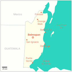
A labeled map answer: Belize is in Central America, below Mexico, beside Guatemala, and on the Caribbean Sea
Belize is a country on the eastern coast of Central America, bordered by Mexico to the north, Guatemala to the west and south, and the Caribbean Sea to the east. It's the only English-speaking country in Central America, with nonstop flights of about two hours from Gulf Coast hubs like Houston and Miami.
Reviewed by RowanLast reviewed July 21, 2026
This guide is built for quick orientation: map labels, bordering countries, common misconceptions, distances from the US, and travel-planning context.
Where in the world
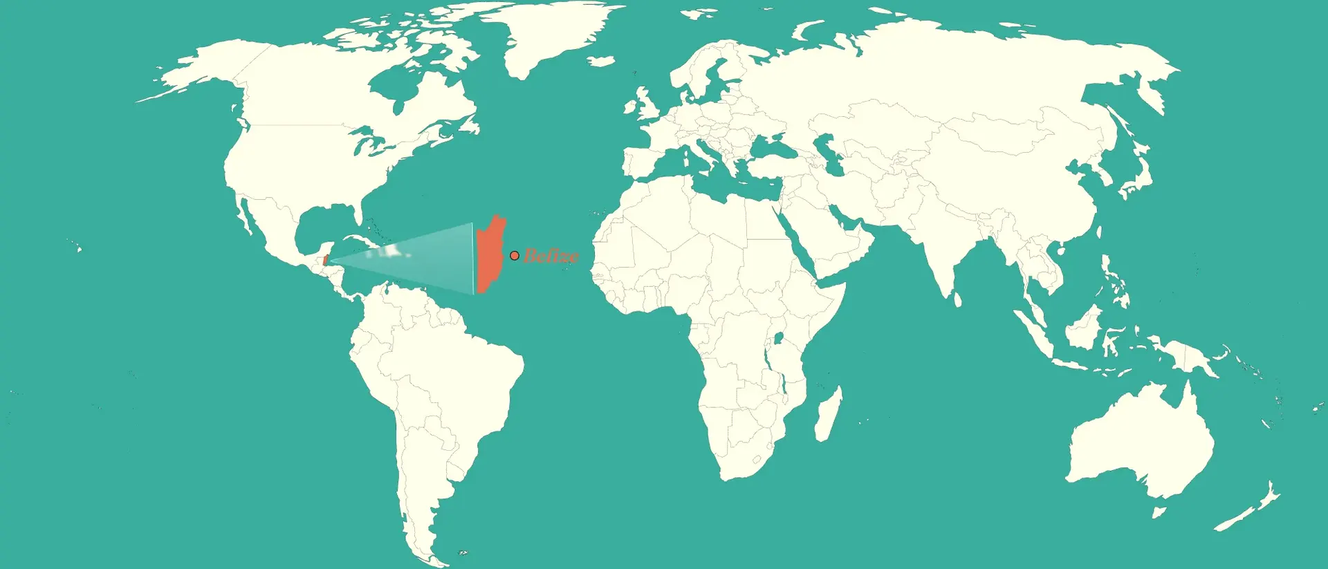
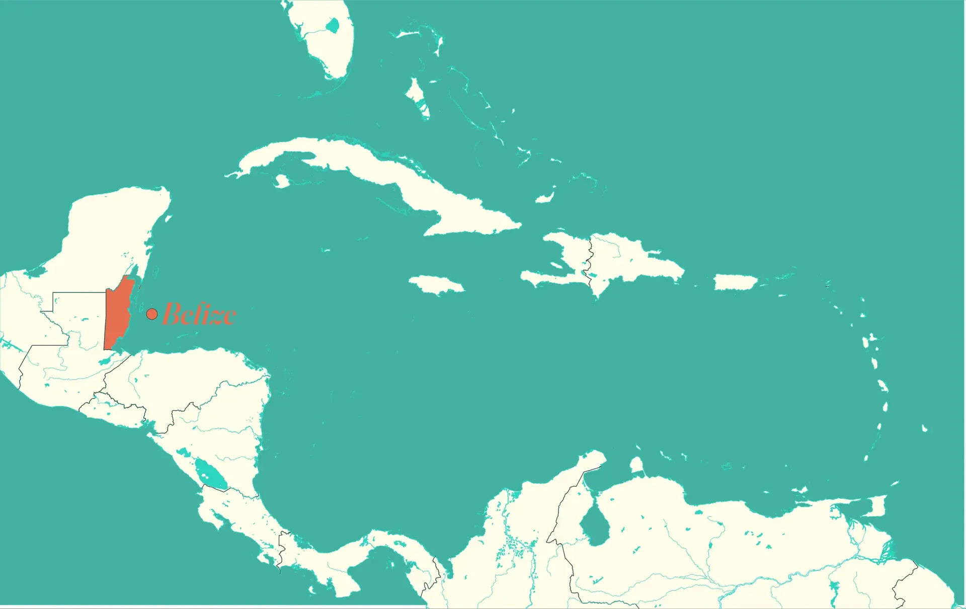
Belize sits on the eastern shoulder of Central America, exactly where the isthmus meets the Caribbean Sea. It tucks under Mexico's Yucatán, leans against Guatemala, and faces open water, which is why it shows up in both Central American and Caribbean searches. Here it is at two scales, from the whole globe down to the region.
North
Mexico (Yucatán)
West & south
Guatemala
East
Caribbean Sea & the reef
Southeast
Honduras, across the water
Bordering countries
Belize borders two countries: Mexico to the north and Guatemala to the west and south. Its entire eastern side faces the Caribbean Sea. Honduras sits southeast across the Gulf of Honduras but does not touch Belize by land.
Travelers driving between countries use two main crossings: Santa Elena, on the Belize side of the Chetumal border with Mexico in the north, and Benque Viejo del Carmen, opposite Melchor de Mencos on the Guatemala border in the west.
North
West & south
East
Southeast
Border and coastline length
Guatemala border
Land border, west and south
Mexico border
Land border, north
Caribbean coastline
Entire eastern edge
Border and coastline lengths per the CIA World Factbook.
Size & scale
Belize covers about 22,966 square kilometers (8,867 square miles), roughly the size of Massachusetts or Wales. The country runs about 290 km (180 mi) from north to south and about 110 km (68 mi) at its widest point, small enough that no inland destination is more than a few hours from the coast.
For travelers, that small footprint means short point-to-point distances, but plan by transfer time rather than map distance: two-lane roads, water taxis, and domestic flights set the pace more than raw kilometers do.
Total area
8,867 sq mi
Comparable to
Similar land area
North to south
≈ 180 mi
East to west
≈ 68 mi at its widest
Landscape
Belize splits into two landscapes. Flat limestone lowlands cover the north and the coastal plain, and the forested Maya Mountains rise in the south-center to Doyle's Delight, the country's highest point at 1,124 m (3,688 ft).
Offshore, the Belize Barrier Reef runs about 300 km (186 mi) along the coast. It is the largest barrier reef in the Northern Hemisphere and a UNESCO World Heritage site, listed in 1996, with more than 450 cayes scattered between the reef and the mainland. Inland, roughly 60 percent of the country is still under forest cover.
For trip planning, the split is simple: the flat north means easy driving days and Maya ruins, while the south-center holds the waterfalls, caves, and ridge lodges.
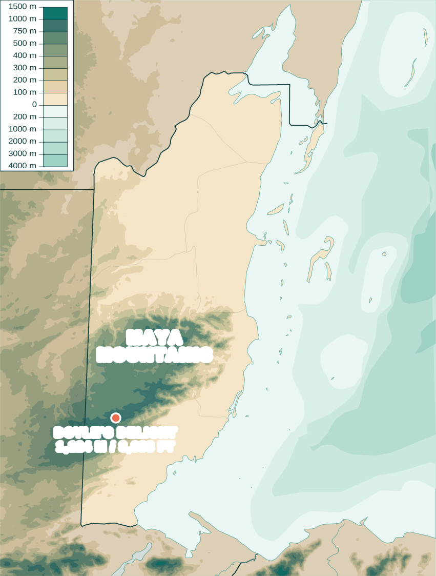
Base map by Urutseg via Wikimedia Commons (CC0 public domain), recolored and annotated by Belize Travel Insider.
Interactive district map
Click a district to see its capital, population, and travel context. This keeps the map useful for the location article while matching the site's Belize-first visual style.
The simple answer
Belize is a small country on the eastern coast of Central America. Mexico is directly north, Guatemala is west and south, and the Caribbean Sea runs along the entire eastern side.
That geography is why Belize often feels like two regions at once: Central American on land, Caribbean on the water. You can wake up near Maya sites and limestone caves, then be on a reef boat the same afternoon.
Insider note
When people say Belize is in the Caribbean, they usually mean the coastline, islands, reef, and culture. Politically and geographically, the country is in Central America.
Common mix-up
Belize shares its northern border with Mexico, but it is an independent country. It also is not in South America; it sits much farther north, in the Central American isthmus between Mexico and Guatemala.
For travelers, that means Belize pairs easily with Mexico's Yucatan or Guatemala's Tikal, but it has its own entry rules, currency, government, and national identity.
Insider note
The land border at Chetumal connects Mexico and Belize, while the western border connects Belize and Guatemala near Benque Viejo del Carmen.
Country vs. city
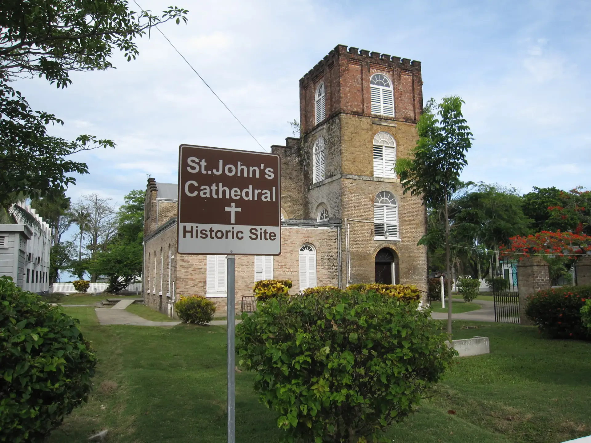
Belize City is the largest city in the country of Belize, sitting on the central Caribbean coast near the mouth of the Belize River. When people search for Belize City, they are looking at a port city inside the country, not a city in Mexico, Guatemala, or the Caribbean islands.
The capital, however, is Belmopan, a planned inland city. Belize City remains the main arrival gateway: the international airport is just outside it, and water taxis to the cayes leave from its harbor.
Insider note
If a flight deal or cruise says "Belize City," that is your entry point to the whole country. Most travelers connect straight on to the islands or inland within a couple of hours.
Its own nation
Belize is a sovereign parliamentary democracy and a member of the Commonwealth. King Charles III is the ceremonial head of state, represented locally by a Governor-General, while an elected prime minister and National Assembly run the government.
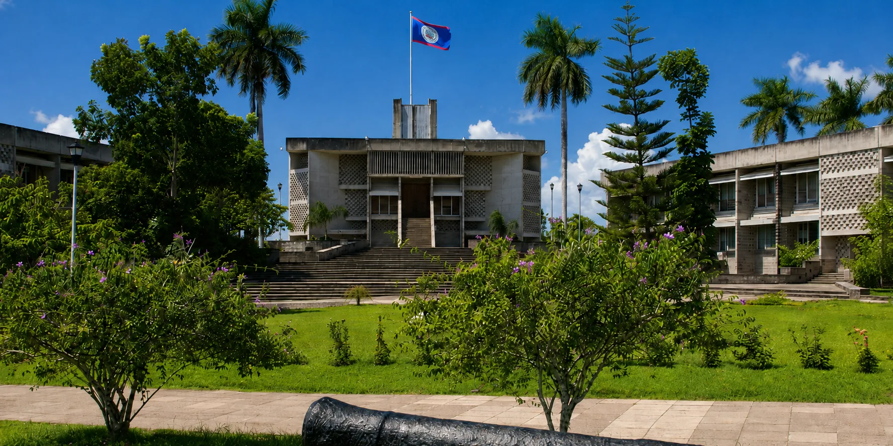
The capital is Belmopan, a planned inland city built after Hurricane Hattie devastated low-lying Belize City in 1961. Belize City is still the largest town and the main gateway most travelers pass through, but the seat of government moved safely inland.
Insider note
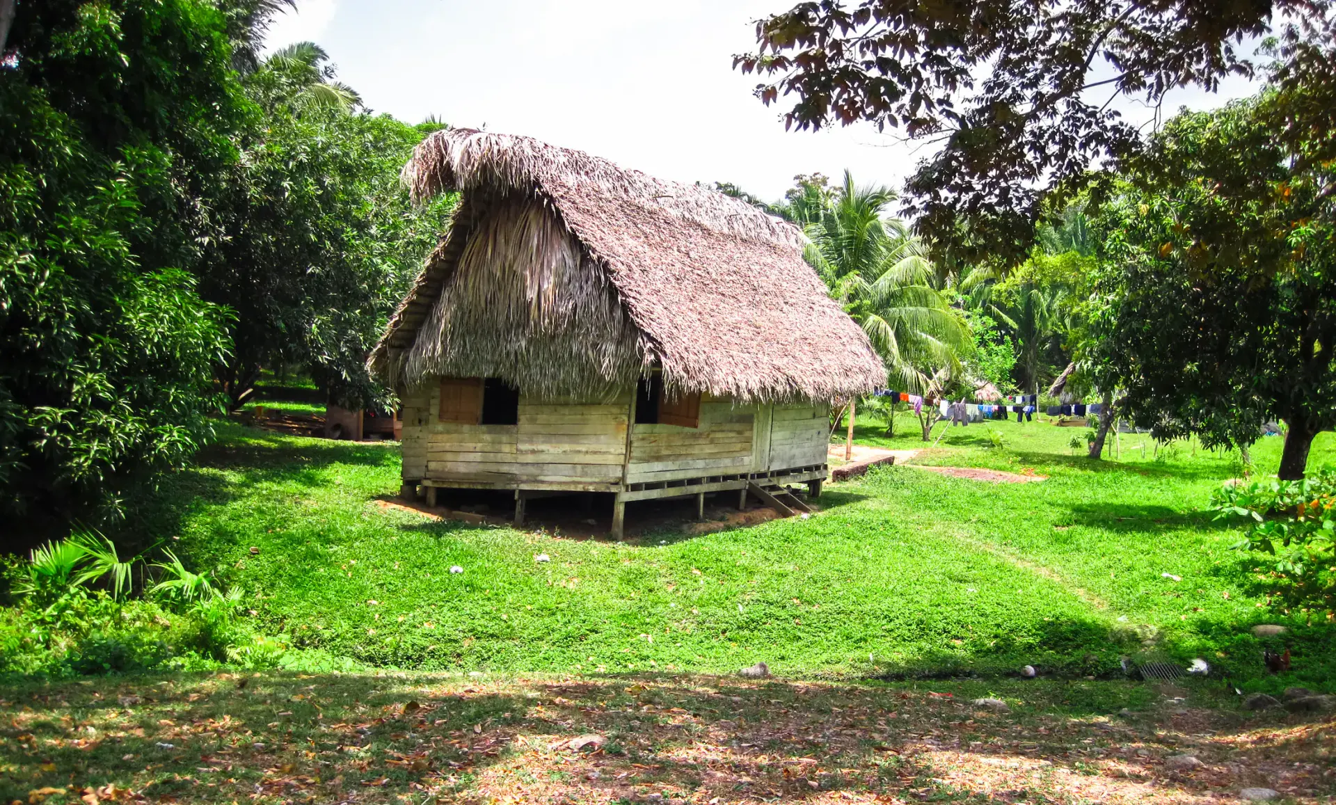
Belize is proudly multicultural: Kriol, Maya, Mestizo, Garifuna, Mennonite, and other communities share one small country, with English as the common official language.
Travel context
International flights land at Philip S. W. Goldson International Airport outside Belize City. From there, travelers usually connect by domestic flight, boat, shuttle, or rental car to islands, beach villages, or inland towns.
The most common first moves are Ambergris Caye or Caye Caulker by air or water taxi, San Ignacio by road, and Placencia or Hopkins by domestic flight or southbound transfer.
Insider note
Belize looks tiny on a world map, but travel times depend on water, ferries, and two-lane roads. Plan routes by transfer time, not distance alone.
Getting to Belize
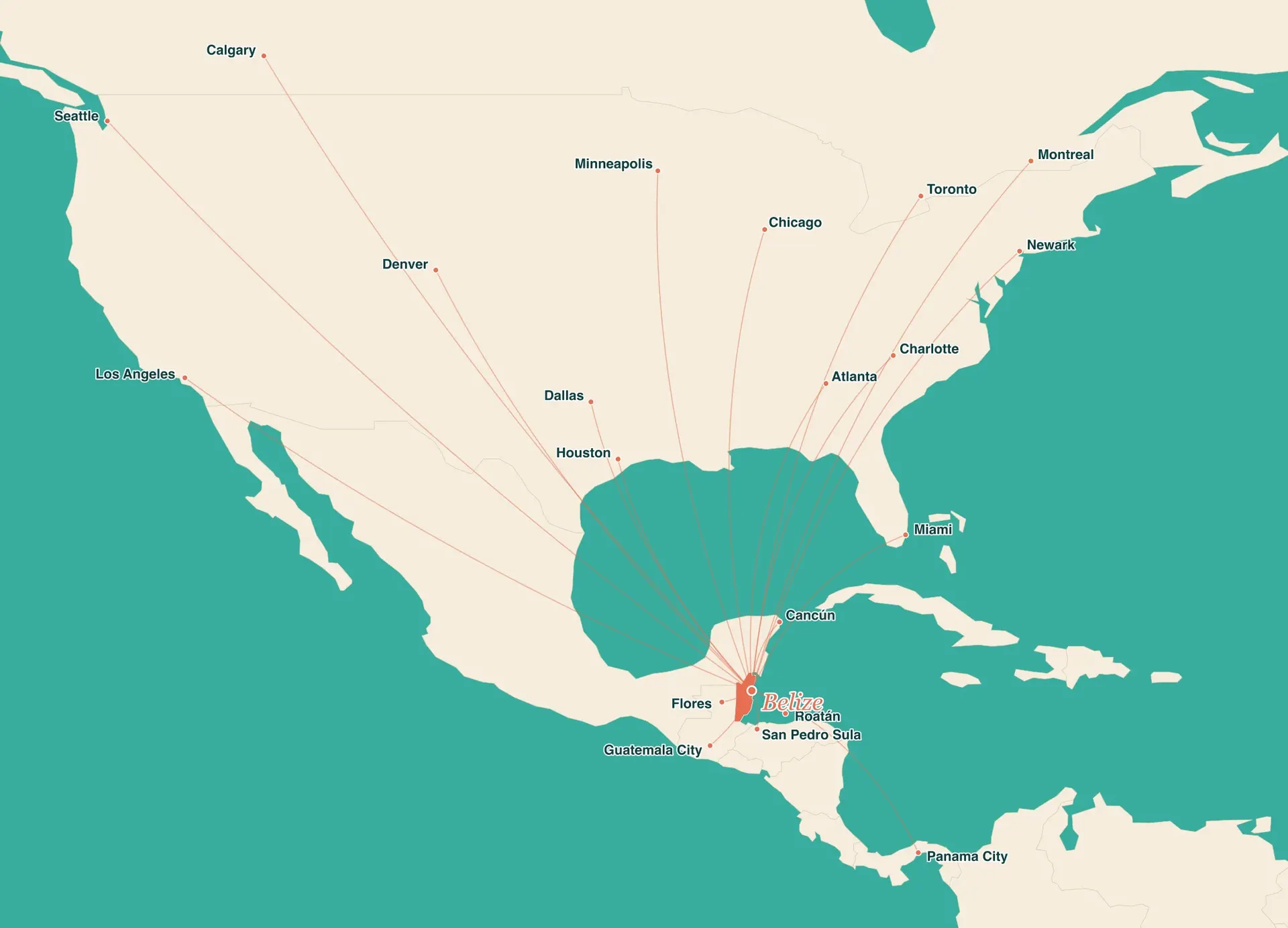
Almost every international visitor lands at Philip S. W. Goldson International Airport (BZE), just outside Belize City. From North and Central America it is a short hop, with nonstop flights from these gateway cities.
From the United States
Miami, Houston, Dallas, Atlanta, Charlotte, Newark, Chicago, Denver, Los Angeles, Seattle, Minneapolis
From Canada
Toronto, Montreal, Calgary
From Mexico & Central America
Cancún, Guatemala City, Flores, San Pedro Sula, Roatán, Panama City
Airlines serving Belize
American, United, Delta, Southwest, Alaska, Air Canada, WestJet, Copa, Tropic Air. Routes and airlines change seasonally, so confirm nonstop options when you book.
After you land, get around BelizeDistance & flight times
Closer than most people guess. Belize is roughly 770 miles from Miami and under 1,000 miles from Houston, about the same flight as New York to Florida. Nonstop flights from southern US hubs take a little over two hours.
| From | Distance | Flight time |
|---|---|---|
| Miami | ≈ 770 mi / 1,240 km | ≈ 2h 15m nonstop |
| Houston | ≈ 970 mi / 1,560 km | ≈ 2h 25m nonstop |
| Atlanta | ≈ 1,175 mi / 1,890 km | ≈ 2h 45m nonstop |
| Dallas | ≈ 1,215 mi / 1,955 km | ≈ 2h 50m nonstop |
| Chicago | ≈ 1,670 mi / 2,690 km | ≈ 3h 50m nonstop |
| Denver | ≈ 1,860 mi / 2,995 km | ≈ 4h 20m nonstop |
| Newark (NYC) | ≈ 1,890 mi / 3,040 km | ≈ 4h 30m nonstop |
| Los Angeles | ≈ 2,170 mi / 3,490 km | ≈ 5h nonstop |
| Toronto | ≈ 2,060 mi / 3,315 km | ≈ 4h 30m nonstop |
| Cancún | ≈ 305 mi / 490 km | ≈ 1h 20m nonstop |
Distances are approximate great-circle figures to Philip S. W. Goldson International Airport (BZE); nonstop times vary by season and routing.
Can you drive to Belize from the US? Yes, but only overland through Mexico. It is a long multi-day drive south to the Santa Elena border crossing near Chetumal, so nearly all visitors fly into Philip S. W. Goldson International Airport (BZE) instead.
Belize at a glance
Region
On the Caribbean coast
Borders
Honduras is southeast across the water
Sea
The reef and cayes sit offshore
Capital
Belize City is the largest city
Coordinates
Approximate country center
Time zone
No daylight saving time
Language
The only English-official country in Central America
Size
About the size of New Jersey
People of Belize
Estimated mid-year population, 2026
Belize has a small national population spread across six districts, with a larger rural share than many first-time visitors expect.
Male
208,499
49.1% of total
Female
215,843
50.9% of total
Urban
175,620
41.4% of total
Rural
248,722
58.6% of total
Districts
All figures are SIB mid-year estimates.
| District | Population | Share |
|---|---|---|
| Belize District | 120,195 | 28.3% |
| Cayo | 107,717 | 25.4% |
| Orange Walk | 57,090 | 13.5% |
| Stann Creek | 53,116 | 12.5% |
| Corozal | 46,831 | 11.0% |
| Toledo | 39,393 | 9.3% |
Source: Statistical Institute of Belize, Mid-year estimates by administrative area and sex, 2015-2026. Last reviewed June 19, 2026.
Before you go
Now that you know where Belize is, here is the practical shortlist for a first trip: the essentials, plus a few dos and don'ts that save time on the ground.
Passport & entry
Most travelers, including those from the US, Canada, UK, EU, and Australia, enter visa-free for up to 30 days.
Money
Fixed at 2 BZD to 1 USD, so US dollars are accepted almost everywhere. Carry small bills for taxis and tips.
Language
Signs and services are easy to navigate in English. Belizean Kriol and Spanish are widely spoken too.
Getting there
International flights land at Philip S. W. Goldson International near Belize City, then connect by air, road, or water taxi.
Getting around BelizeDo
Don't
Plan around the map
Domestic flights, water taxis, shuttles, buses, and realistic transfer times.
Open guideFrom the ancient Maya through British Honduras to independence in 1981.
Open guideThe only national flag with people on it, plus the toucan, tapir, and black orchid.
Open guideThe Belize Dollar, the fixed 2:1 US dollar rate, and how to pay on the ground.
Open guideCompare islands, beach villages, jungle bases, and mainland towns.
Open guideA reef-and-jungle route that makes the country layout click.
Open guideWhat the Level 2 travel advisory means, the one area to skip, and where visitors stay safe.
Open guideQuestions travelers ask
Belize is located on the eastern coast of Central America, south of Mexico, east and north of Guatemala, and west of the Caribbean Sea.
On a map, Belize sits on the Caribbean coast of Central America, directly below Mexico's Yucatan Peninsula and east of Guatemala. Look for the small country between Mexico's Quintana Roo state to the north and Guatemala to the west and south, with the Caribbean Sea and the Belize Barrier Reef along its entire eastern edge. Its approximate center is 17.19 degrees north and 88.50 degrees west.
Belize is geographically and politically in Central America. It also has a strong Caribbean identity because its eastern coastline, offshore cayes, and Barrier Reef face the Caribbean Sea.
No. Belize is an independent country. It borders Mexico to the north, but it has its own government, currency, border rules, and official language.
Belize borders Mexico to the north and Guatemala to the west and south. Honduras is southeast across the Gulf of Honduras, but it does not share a land border with Belize.
No. Belize is a mainland country with a Caribbean coastline. It also has many offshore islands, locally called cayes, including Ambergris Caye and Caye Caulker.
Belize is on the Caribbean Sea. The Belize Barrier Reef runs offshore along the coast, with islands and marine reserves between the mainland and open water.
Belize City is located on the central coast of Belize, on the Caribbean Sea near the mouth of the Belize River. It is the country's largest city and main arrival gateway, though the capital is inland Belmopan.
San Pedro is the main town on Ambergris Caye, Belize's largest island, off the country's northeast coast near the Mexican border. It sits about 35 miles (56 km) northeast of Belize City, reached by a 15-minute domestic flight or a roughly 90-minute water taxi. Belize's other popular island and beach bases are Caye Caulker, just south of Ambergris Caye, and Placencia, a peninsula on the southern mainland coast.
The Belize Barrier Reef runs along the country's Caribbean coast, just offshore from the mainland and the cayes. It is the largest barrier reef in the Northern Hemisphere and a UNESCO World Heritage site.
The capital of Belize is Belmopan. Belize City is the largest city and the main historic port, but it is not the capital.
Belize gained full independence from the United Kingdom on September 21, 1981. It was previously the British colony of British Honduras, which was renamed Belize in 1973.
Belize is an independent country and a member of the Commonwealth. King Charles III is the ceremonial head of state, represented by a Governor-General, while an elected prime minister and National Assembly run the government.
Belize is in North America. Central America, where Belize sits, is the southern part of the North American continent. Belize is not in South America: the South American mainland starts roughly 1,300 miles (2,100 km) to the southeast, past Panama.
Yes. All visitors need a valid passport. Many travelers, including those from the US, Canada, UK, EU, and Australia, can enter visa-free for up to 30 days.
A useful country-center coordinate for Belize is approximately 17.19 degrees north latitude and 88.50 degrees west longitude.
Belize is close by air: about 770 miles (2h 15m nonstop) from Miami and 970 miles (2h 25m nonstop) from Houston, the two closest major US gateways. Flight time stretches out from farther cities, roughly 2h 45m from Atlanta, 3h 50m from Chicago, and up to 5 hours from Los Angeles or Newark.
Yes. Nonstop flights to Belize (BZE) run from U.S. gateways such as Miami, Houston, Dallas, Atlanta, Charlotte, Newark, and Chicago, from Toronto and other Canadian cities, and from regional hubs like Cancún, Guatemala City, and Panama City. Routes and airlines change seasonally, so confirm nonstop options when you book.
English is the official language of Belize. Belizean Kriol, Spanish, Maya languages, Garifuna, and other languages are also widely heard.
Belize covers about 22,966 square kilometers (8,867 square miles), roughly the size of Massachusetts or Wales. It runs about 290 km (180 mi) north to south and about 110 km (68 mi) at its widest point.
Yes, but only through Mexico. Driving from the US means crossing into Mexico and continuing south to the Santa Elena border crossing near Chetumal, a multi-day trip. Most visitors fly into Philip S. W. Goldson International Airport (BZE) instead.
The highest point in Belize is Doyle's Delight at 1,124 m (3,688 ft), deep in the Maya Mountains near the boundary of the Cayo and Toledo districts. Victoria Peak, at 1,120 m (3,675 ft) in the Cockscomb range, is the better-known summit and a popular guided multi-day climb.
Use the geography to choose the right mix of reef, islands, villages, and inland adventure days.