Loading page content.
Loading Planning Guides
Preparing itineraries, logistics, and practical travel tools.
Compiling planning guides and trip resources tailored for Belize.
Loading page content.
Loading Planning Guides
Preparing itineraries, logistics, and practical travel tools.
Compiling planning guides and trip resources tailored for Belize.
Stay in the know
Belize
before
everyone else.
Events, hidden gems, seasonal highlights, and local stories, delivered straight to your inbox before they go viral.
Loading page content.
Loading Travel Tips
Compiling essential tips and advice for visiting Belize.
Preparing destination details and local recommendations.
Keep Planning
Related Plan Guides
Health & Safety
Belize health & safety, the practical side: tap water, mosquitoes and Zika, vaccines, marine and dive hazards, clinics, and travel insurance for 2026.
Budget Planning
How much Belize costs by travel style, with sample budgets for San Ignacio, Caye Caulker, Placencia, San Pedro, transfers, tours, food, and cash planning.
Getting Around
Getting around Belize made simple: water taxi schedules to the cayes, Tropic Air domestic flights, NBC bus timetables, BZE airport transfers, shuttles, and rental cars.
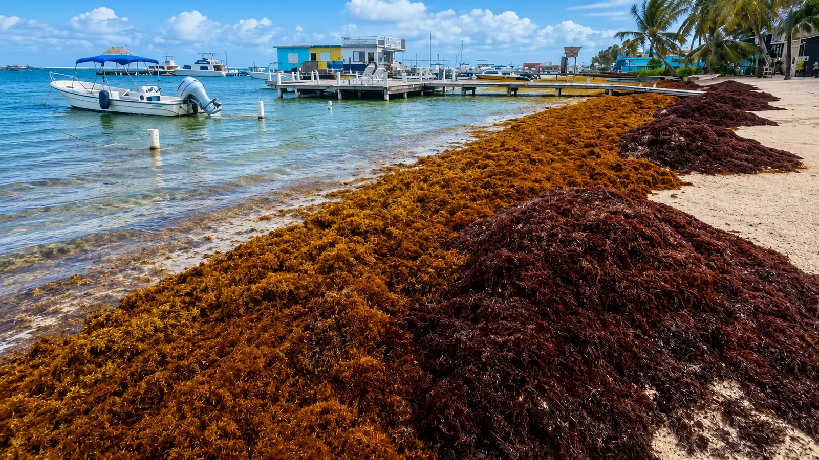
Where the seaweed is right now, from NOAA satellite data · updated daily for the Caribbean and Belize
This page tracks floating sargassum across the Caribbean in near-real time and translates it into a beach-level risk read for Belize. The regional map shows the open-ocean signal from NOAA; the forecast below it shows what that means for Ambergris Caye, Caye Caulker, Placencia, and Hopkins this week.
Reviewed by RowanLast reviewed August 30, 2026
Map data: NOAA CoastWatch, refreshed daily
Sargassum conditions change week to week. Check Belize forecasts, NOAA/AOML reports, and local operator updates before travel, especially June through October.
Quick Navigation
Live regional conditions
Use this live sargassum seaweed map for 2026 to see the 7-day floating sargassum signal across the Caribbean before it drifts toward Belize.
Daily coastal risk
This daily sargassum inundation risk forecast is clipped to the Belize coast and updated from NOAA SIR data. It estimates how likely floating sargassum is to reach the shoreline, the practical step beyond the open-ocean map.
Coloured stretches show forecast risk along the coast and cayes, from low through high. For Belize sargassum season and Belize seaweed season planning, use this with the NMS beach forecast for town-level detail.
Open the NOAA SIR reportFrom conditions to a better beach
The forecast tells you where sargassum may land. The next guide shows the west-facing beaches, lagoon swims, reef water, and inland alternatives that stay clearer when the exposed coast is affected.
Stay smart in seaweed season
Your hotel's side of the island matters more than the forecast. These bases keep a reliable swim within reach even in a heavy season.
Secret Beach and the lagoon side face west, so the island itself blocks the seaweed.
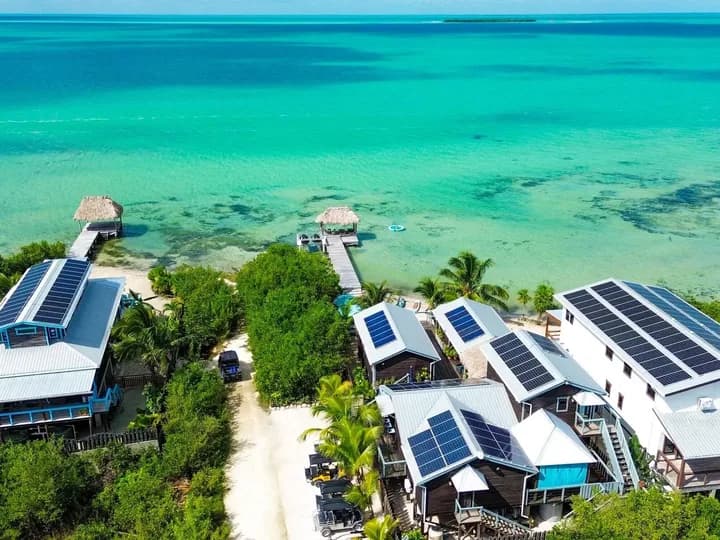
West-side cove by Secret Beach, shallow and clear
Secret Beach · $249–$300/night
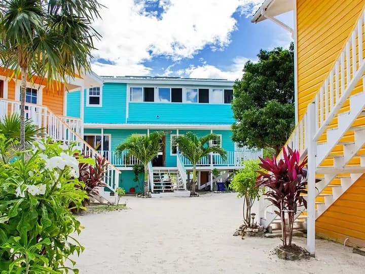
On Secret Beach itself, shallow lagoon swim
Secret Beach · $163-$200/night
Rivers, waterfalls, and cave pools inland, where sargassum never reaches.
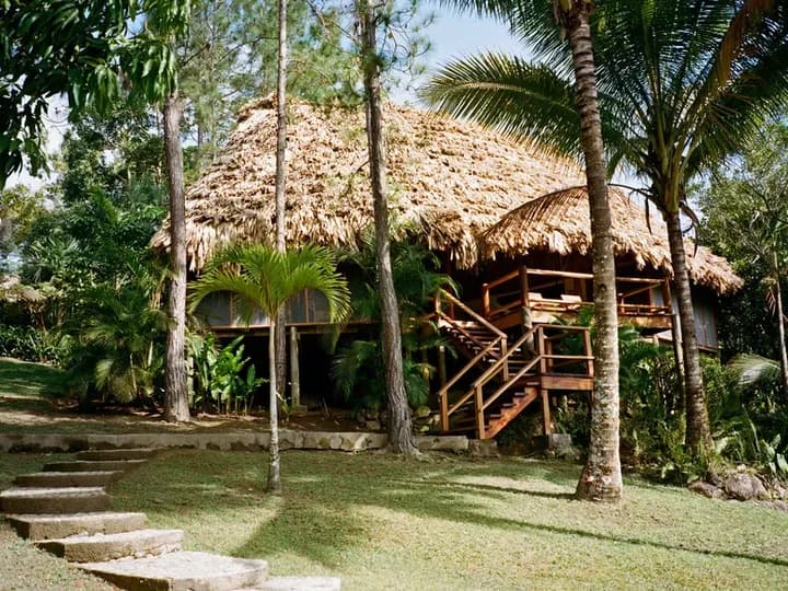
Mountain Pine Ridge rivers and waterfalls
Mountain Pine Ridge · $400-$1200 per night
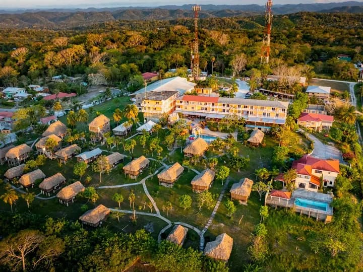
Hilltop base above San Ignacio
San Ignacio, Cayo · From $129 USD/night
Beyond Belize
The satellite layer covers the whole basin, so the same image answers the question for any coastline. Three reads that make sense of it:
The belt drifts east to west, so Barbados and the eastern Caribbean meet each pulse weeks before the western Caribbean does. When the east side of the map lights up, the west has lead time to watch.
Cancun, Playa del Carmen, and Tulum sit on an exposed shoreline that faces the open Caribbean, which is why they usually take the heaviest landings in the region. A dense signal off Cozumel typically reaches those beaches within days.
Here the barrier reef and lagoon sit between the open sea and most swimming areas, so an offshore signal is a warning, not a verdict. The risk forecast above turns the same satellite data into the beach-level read.
Cross-check any read with the scientists: USF's Sargassum Watch System publishes monthly outlook bulletins for the basin, and NOAA's daily Sargassum Inundation Risk grades coastal risk from the same satellite family this page uses.
From map to plan
The season month by month, region by region, and how travelers plan around it
Open guideThe leeward shores, lagoon sides, and inner-reef spots that stay clear
Open guideBalance sargassum season against weather, crowds, and prices
Open guideSargassum alerts
One email a week during the season: where sargassum is landing, which coasts are staying clear, and what it means for your beach days. Built from the same NMS and NOAA data as this tracker.
Free. No spam. Unsubscribe anytime.
This page. The map above is rendered from NOAA CoastWatch satellite data (the USF Alternative Floating Algae Index) and refreshes daily, showing the 7-day cumulative floating-sargassum signal across the Caribbean basin, including the waters east of Belize.
Daily. The map is served directly from NOAA's latest published satellite field, and NOAA's own date stamp is visible on the image so you can confirm how current it is. The Belize beach-risk forecast below it updates on the same cadence.
Brighter greens, yellows, and reds mean denser floating sargassum; blues and purples mean clear open water. It shows the open-ocean picture, not beach-by-beach conditions: seaweed visible offshore can take days to arrive, drift elsewhere, or be blocked by Belize's barrier reef before it reaches swimming areas.
Not necessarily. Belize's barrier reef blocks much of the floating sargassum from reaching inner-reef and lagoon swimming areas, and impact varies sharply by coast: east-facing mainland beaches get the most, leeward caye shores and lagoon sides stay clearer. Check the per-region risk forecast on this page for the beach-level picture.
The main season runs roughly March through October, peaking June to August. Arrivals vary week to week with wind and currents, which is exactly why a live map beats a static seasonal chart. For month-by-month planning, see our full Belize sargassum guide.
Yes: the satellite tracker on this page covers the entire Caribbean basin, not just Belize. NOAA's floating-algae signal spans the full belt from the eastern islands through the Yucatan, so you can check any coastline on the same image, then use the Belize risk forecast for the beach-level read here.
For bloggers and hotels
Writing about sargassum, or answering the same guest question every week? Embed the live Belize tracker for free: the daily NOAA risk map and NMS beach forecast, always current, no maintenance on your end.
Copy the snippet, paste it into any page or post, and keep the credit line so your readers can find the full tracker.
Beyond the seaweed
San Ignacio and the cayes, with reef and jungle days planned day by day
Open guideThree nights in San Ignacio and four on the cayes, planned day by day
Open guideReal daily budgets for food, hotels, tours, and transport
Open guideCompare dry season, green season, sargassum, crowds, and value month by month
Open guideMost weeks, most of Belize's swimming water is clear, and now you can verify that yourself before you commit to a beach.